GIS services with actionable intelligence for planning, design, and operations
Geographic Information System solutions to visualize, model, and analyze complex engineering and geographic scenarios
Geospatial (GIS) services
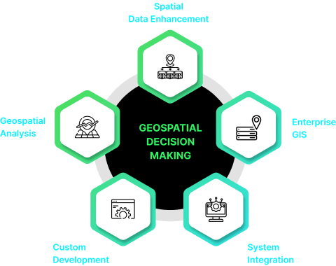
SoftTech offers a comprehensive suite of geospatial services, including base map creation, DGPS surveying, field surveying, drone and LiDAR surveys, and enterprise GIS platform development, along with customized web GIS and mobile applications.
GIS Solutions through ESRI partnership
Partnership with ESRI for GIS Solutions SoftTech is the leading authorized partner of ESRI India, providing access to ESRI’s cutting-edge mapping and location analytics software. ESRI’s ArcGIS products are designed to support organizations of all sizes, running seamlessly on cloud, desktop, centralized servers, and mobile devices. We offer the diverse range of GIS software products including ArcGIS Desktop, ArcGIS Server, ArcGIS Online, and ArcGIS for Developers.
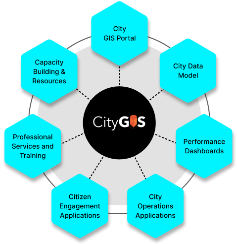
As an authorized partner, SoftTech delivers ESRI’s City GIS Solution, a Geo-enabled City Management Solution tailored for municipal corporations. This comprehensive solution enhances governance, operational efficiency, citizen services, and day-to-day operations such as inspections, maintenance, project management, revenue enhancement, and investment planning.
Built on ESRI’s ArcGIS platform, CityGIS provides preconfigured dashboards and applications for efficient city management. SoftTech, in collaboration with ESRI India, not only offers complete CityGIS solutions but also provides tools for project planning, implementation, and monitoring through various applications and dashboards.
Drone survey solutions
SoftTech offers comprehensive drone survey services utilizing DGCA-approved drones, encompassing everything from DGPS Survey and GCP marking to drone data acquisition, processing, and analysis. Our services yield a range of outputs, including orthomosaic, 3D point cloud, 3D mesh model, contour maps, DEM, DSM, DTM, and 2D/3D vector data.

Mobile LiDAR survey
At SoftTech, we specialize in Mobile LiDAR Survey solutions, enabling the seamless collection of LiDAR point clouds from moving platforms. Our advanced systems incorporate LiDAR sensors, cameras, GPS, and inertial navigation systems (INS) mounted on vehicles.

Customized GIS application development
Mobile App for field survey and data collection

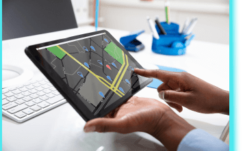
SoftTech creates bespoke mobile applications designed to meet project-specific needs for geo-enabled surveys and field-based verifications. Our mobile apps streamline the collection of spatial and non-spatial attributes for diverse assets, ensuring seamless data gathering and management in the field.

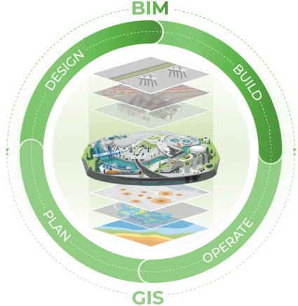
GIS + BIM services
Our comprehensive solutions combine the spatial intelligence of GIS with the detailed modeling capabilities of BIM, empowering you to achieve unparalleled efficiency and accuracy throughout every stage of your construction projects.
From initial planning and design to construction and ongoing management, our GIS + BIM services revolutionize the way you approach building and infrastructure projects. With our expertise, you can streamline project coordination, optimize resource allocation, mitigate risks, and enhance decision-making processes.
